


Price
£440-£680
Verdict
Pros and Cons
Noone has commented on this article yet.
Filed under:
Gear reviews, GPS Devices,Jon Doran tries out a rugged, all-seasons, outdoors-specific GPS unit running Ordnance Survey mapping...
Satmap’s earlier GPS units – the Active 10 and Active 12 – were pretty much the first out there designed specifically for outdoors use and combined comprehensive and familiar Ordnance Survey mapping with glove-friendly, button-operated controls and a user-interface that you could get the hang of pretty much instantly.
There’s was lots to like about them, but also some flaws. The screen’s polycarbonate protector scratched really easily. Weather proofing was limited. And the unit sometimes felt a little slow to scroll and zoom mapping. The basics, clear OS maps with a pinpoint accurate representation of where you are, where you’ve been and where you’re going were all spot on though. As was the operating system, which worked in a predictable, uncomplicated way.
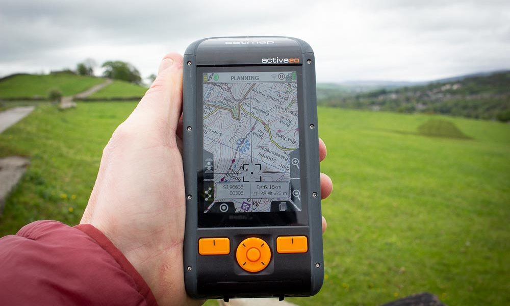
The Active 20 was designed to build on the positives and improve the bits that weren’t so great. So you get the same mapping, but on a clearer screen protected by 2.5mm Gorilla Glass. The button controls are still there, but you can cover all the same functions via touch screen control. And the unit is now water resistant to IP68 standard – normal wet weather use shouldn’t ever be an issue. The downside to all the refinement is that the unit is appreciably larger than its predecessors and weightier too. Some 312g compared to 207g for an Active 12. A lot of that is down to the bigger, heavier battery, which in turn is needed to power the high-res colour screen.
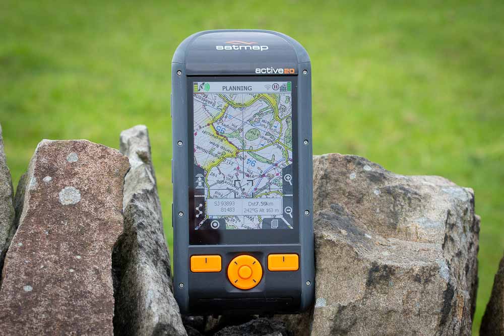
The mapping, in this case full UK Ordnance Survey maps at 1:10,000, 1:25,000 and 1:50,000 scale, is supplied on a single Micro SD card. This spec makes it scary expensive at £680 all in, but you can opt for less comprehensive maps with prices starting from £440. It all feels super solid and well engineered with a proper rugged vibe to it.
The Active 20’s screen is super clear and much tougher than previous models
How it works
It’s easy to get carried away with tech specs, processor speeds, antenna sizes and so on, but all you really need to know is that the unit gets a satellite fix super quickly and then displays your position on a stunningly clear – did someone say ‘cinematic’ – Ordnance Survey map. You can toggle between different scales using a button press and zoom in and out in the same way. Or press and pinch in familiar smartphone mode. In really simple terms, it just shows you exactly where you are on a map. If you want to follow a route, things get a little more complicated. You’ll need to create a GPX file either using Satmap’s own online route planner or from elsewhere and then convert the file into Satmap’s own format version using free Satmap software before copying it onto the unit via a USB cable.
Once it’s on board, select the route and it’ll show up as a line complete with direction arrows on your map screen. In simple terms you can then just follow it either using spatial judgement or, if you need to, engage the compass screen and a press of a button brings a pointer which will indicate the direction to the next waypoint on your route. It’s reassuringly straightforward. Also easy to use is the Trip screen where you can view your ongoing stats and also choose to save your latest walk, run or ride for later use or to share or upload to a third-party site. That might all sound quite obvious, but you’d be amazed at how tricky some GPS units make all this basic stuff. Or you might not.
Power and points
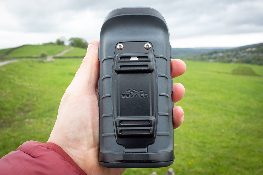
So the mapping’s brilliant, the screen’s bright, clear and easy to manipulate and the build quality is super solid. All of which is good, as is battery life from the big, slide-out, USB-chargeable LiPo cell, easily enough for a long day in the hills in our experience. You can optimise things further by playing with screen brightness, automatic screen turn-off and GPS sampling frequency in the comprehensive settings menu. One connected niggle here is that the rubber cover over the USN port pulls off very easily. A spare is supplied and you can buy more in multi-packs, but you really shouldn’t have to.
The other physical factor is that the Active 20 is so big. Whereas most GPS units will fit into a jacket pocket quite happily, the Satmap is a bit of a brick, not quite on the scale of those early cell-phones you sometimes spot in old films, but you get the idea. To be fair, it sits in the hand okay, it’s just awkward finding somewhere accessible to stow it when not in use. Pack belt pockets again tend to be too small. Otherwise it’s anatomically reassuringly tough. Also reassuring is the ability to use it with bulky gloves thanks to the push-button controls. Mostly we found ourselves using them in preference to the touchscreen option, but if you’re a habitual smartphone user, you’ll appreciate the choice. One other thing on the power side of the equation, you can, if you want, buy an optional AA battery holder as a back-up for £20 or a spare LiPo battery for £40 for multi-day outings with limited charging options.
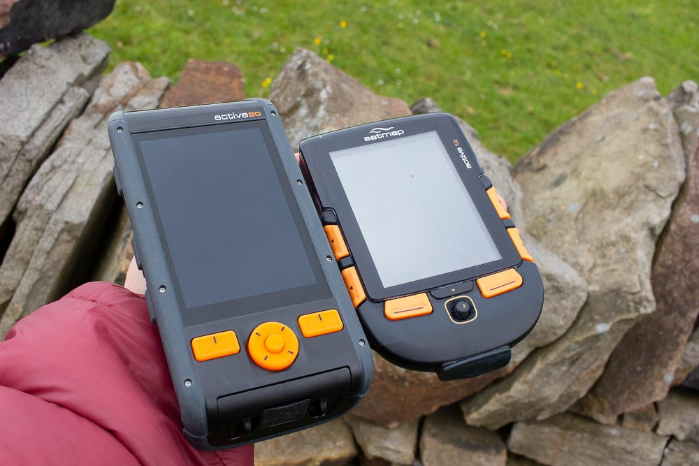
Active 20 side by side with the Active 12
Files and connectivity
Where things are less sorted is when it comes to connectivity. The unit has wifi, which it uses to connect to a home network and check for software upgrades, but disappointingly, it doesn’t take things a stage further and use the same network to upload track files to third party platforms. Instead you have to connect manually to a computer then copy files over, convert them to GPX then upload manually to your chosen site. Similarly, Bluetooth allows you to share files with other Satmap units or connect Bluetooth devices, but not to communicate with your computer wirelessly. None of this is world-endingly bad and you don’t find yourself enmeshed in Garmin-style software, but it seems a shame that so much potential functionality has been left unexploited.
The same’s true with mapping. Because it’s supplied on micro SD cards – options include comprehensive mapping for many areas both in the UK and abroad – you can’t simply buy and download maps at short notice, you’re reliant on the postman to deliver it to your door.
Verdict
It’s big, bulky, reassuring rugged and a tad heavy, but if what you want is simply excellent reproduction of Ordnance Survey mapping along with routes, tracks and an indicator of where you are, the Satmap Active 20 is one of the best options out there for all-weather, outdoor navigation. Throw in decent battery life, an easy-to-use interface that won’t fry your brain as you try to find out where the trip meter is hidden or how to adjust the screen brightness, and an excellent choice of premium maps covering a big portion of the globe and it’s all good. If there’s a downside, it’s that you’ll need deep pockets, both literally and figuratively. And if you’re someone who prizes seamless transfer of data too and from the unit and beyond, you may find things slightly clunky. But for core walking and mountaineering navigational use, the Active 20 is hard to to beat and, in my experience, more than a match for the produced by larger, less specialist tech brands.
More info: www.satmap.com


