


Noone has commented on this article yet.
Filed under:
All Featured Stories, Features, Features Spotlight, Magazine, Special Features,Looking for some new challenges in 2026? Mountaineering instructor Rebecca Coles suggests 20 epic homegrown mountain adventures to keep you busy during the year ahead…
The British Isles has some of the most varied mountain landscapes squeezed into a small area of almost anywhere in the world. There is nothing more inspiring than being stood on a mountaintop looking out to sea or emerging from ancient forests to the expanse of wide-open moorland. Sinuous lines of mountain ridges and iconic silhouettes such as that of Tryfan are ever enticing. Combine the variety of mountain landscapes with the UK’s liberal access laws, tolerance of responsible wild camping (is permitted in law in Scotland in all but a few tiny areas), long distance trails which crisscross the country as well as high-level mountain traverses and adventurous scrambles, why would you want to go anywhere else?
Challenges in the mountains come in different forms. The challenge could be because of technical difficulty, whether sustained or short-lived. The exhilaration of making an airy move, or the satisfaction of the mind being as tired as the body, from the focus required on consequential ground. Other challenges might be long distances covered, or multiple summits to be ticked off and – once into multi-day journeys – the logistics and preparations needed to successfully complete the route. It’s difficult to pick just 20 British mountain challenges, but this list represents some of the best mountain adventures to be had across the UK. All routes are described in summer conditions, but many are enjoyable in winter too.
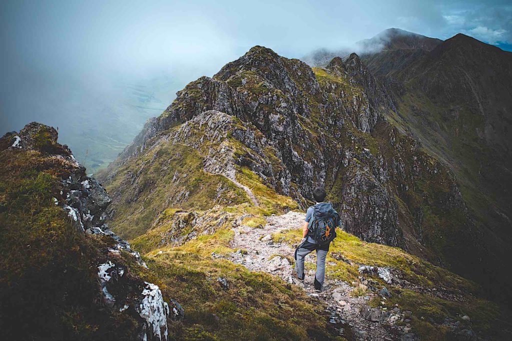
Nantlle Ridge, Snowdonia
Distance: 14km
Ascent: 925m
Technical Difficulty: Briefly Grade 1 scrambling
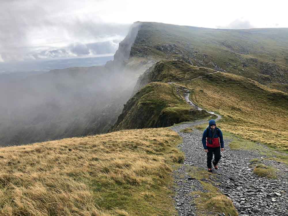
Tucked away from the hustle and bustle of the Snowdon and Glyderau ranges is the Nantlle Ridge, an elegant line of peaks which stretch from Rhyd-Ddu to Cwm Silyn. The route starts below Snowdon at the Rhyd-Ddu train station where a well-made path leads to the open slopes of Y Garn from where the Nantlle Ridge is gained. The next peak on the ridge, Mynydd Drws-y-coed, provides some short-lived rocky scrambling at an escapable Grade 1. The remainder of the ridge is not so rocky and allows unhindered progress with vistas towards the coast and Llyn Peninsula as well as Snowdon. On Mynydd Tal-y-Mignedd it is possible to either backtrack slightly after gaining the summit and head south into the Beddgelert forest to return to Rhyd-Ddu in order to make it a circular walk. Or, if the plan is to complete the ridge, continue to Garnedd-Goch where a descent to a roadhead, used by climbers to access Cwm Silyn, is made. The roadhead is remote so some transport logistics need to have been thought about prior to setting out, otherwise you’d find yourself stranded.
Cadair Idris makes for a quieter day out than elsewhere in Snowdonia – Image: Rebecca Coles
Cadair Idris, Snowdonia
Distance: 10km
Ascent: 880m
Technical Difficulty: Mountain walk
Snowdonia National Park is the fourth largest National Park in the UK, and extends much further south from the summit of Snowdon than many realise. One area to be found in the south of the park is the impressive massif of Cadair Idris, rising above Dolgellau. A number of routes lead to the summit but a great circular route can be accessed from the south of the mountain up the Minffordd Path. This path is the shortest, and consequently steepest, to the summit. It rises on steps through the mature forest towards Cwm Cau before another steep ascent gains the rim of the cwm above Llyn Cau, giving spectacular views. For a satisfying circular route, it is possible to continue on the now broad ridge to the secondary summit of Mynedd Moel, from where a descent to the south can be made back to the parking at Dol-y-cae.
The iconic ridge line of Crib Goch – Image: Simon Verspeak, Orange Mountaineering
Welsh 3000s, Snowdonia
Distance: 47km
Ascent: 3400m
Technical Difficulty: The majority is mountain walking with some Grade 1 scrambling
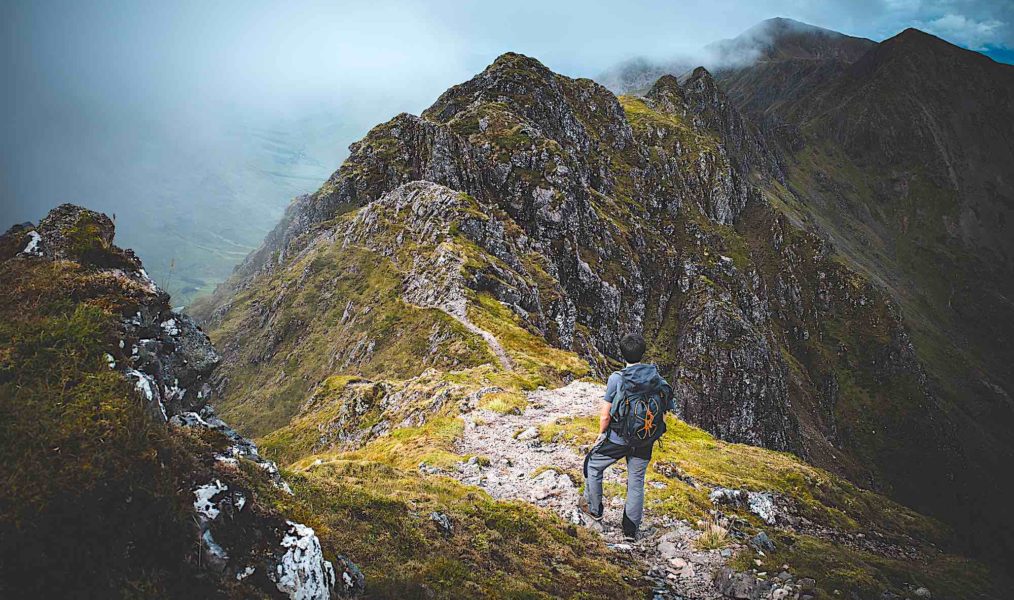
This classic outing in the Welsh hills ascends and traverses the three major ranges in Snowdonia – Snowdon, Glyderau and the Carneddau – taking in all the 3000ft mountains in Wales in a continuous journey. It can be done in one push which involves anywhere between 12-24 hours of walking for most mortals. Alternatively, it naturally splits into three days which allows for a more leisurely pace whilst still remaining demanding. As this is a linear route, some planning is required with transport. The route is mostly begun on Snowdon, although it can be done in either direction. Sections on the Snowdon range and Glyderau involve some fairly stiff Grade 1 scrambling, sometimes in descent depending on the exact route taken. The only unavoidable scrambling on the route is Crib Goch which is infamous for its exposed ridge.
Bannau Sir Gaer ridge on the Black Mountain – Image: Aled Davies, Expeditions Wales
Bannau Sir Gaer and Fan Bryncheiniog, Brecon Beacons
Distance: 22.5km
Ascent: 1100m
Technical Difficulty: Mountain walk
At the western end of the Brecon Beacons is the Black Mountain. It’s set in a geologically fascinating area in which red Beacons sandstone overlies limestone where vast caves are hidden. Aviation historians are also drawn to the area as it has many aircraft crash sites. From the Dan-yr-Ogof show caves, it’s possible to take a clockwise or anti-clockwise route over the ridge of Bannau Sir Gaer. Going clockwise takes you through the karst limestone landscape maze where crash sites are located. Note that this route includes a couple of fords which can quickly become difficult to cross in heavy rain. From the head of the valley many people take in
Gerrag Las to include another Hewitt on the walk, but it is possible to miss this and continue onto Waun Lefrith from where the main ridge is gained which leads to the summit of Fan Brycheiniog, followed by a long sweeping descent along Fan Hir. A shorter route, which still incorporates the Bannau Sir Gaer and also avoids the fords, can be taken from the north, where access can be gained from the parking at the fisheries near Llanddeusant.
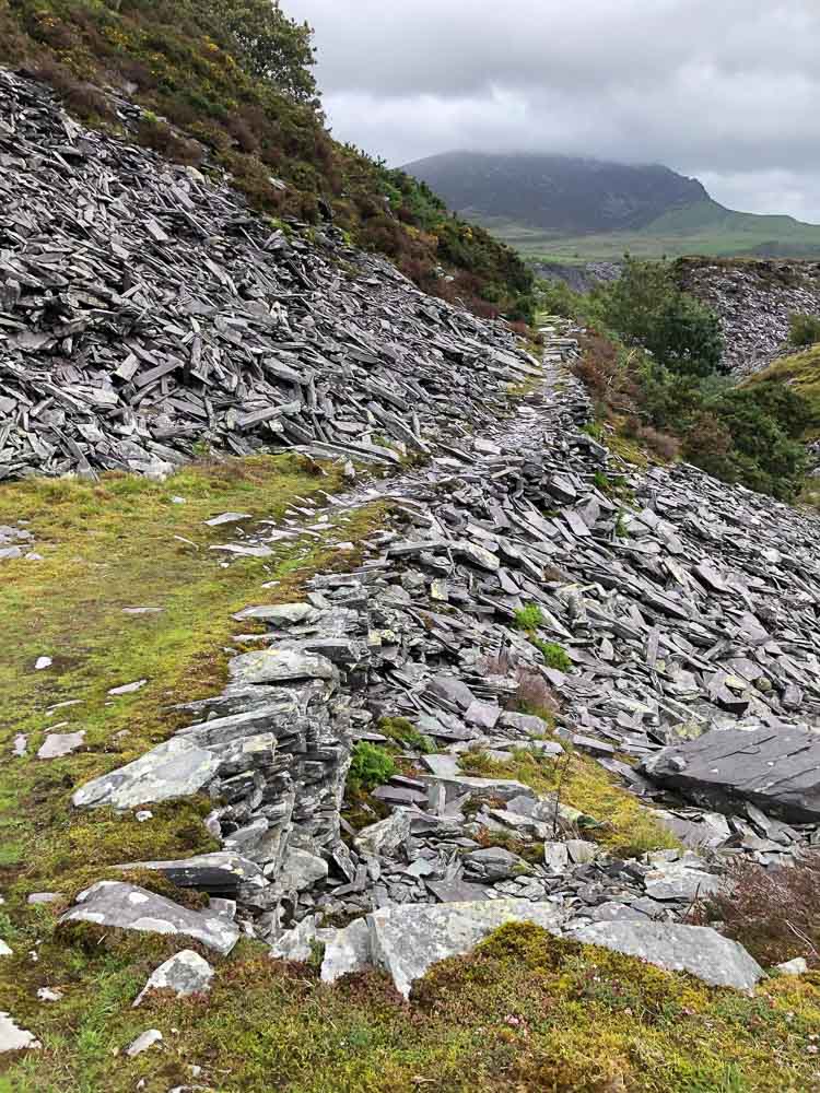
The 133km-long Snowdonia Slate Trail – Image: Rebecca Coles
Snowdonia Slate Trail, North Wales
Distance: 133km
Ascent: 4355m
Technical Difficulty: Long-distance trail
This long-distance walk is a more recent addition to the network of trails across the UK. It is a 83 mile (133km) circular route via the slate quarries of North Wales. At the height of the slate industry, North Wales provided a third of the world’s slate tiles, which require the highest quality slate. The route links the quarries on a trail through the mountains such as the Ogwen valley and Cwm Orthin in the Moelwyns. Other highlights which the trail incorporates are the fisherman’s trail in Aber Glaslyn Gorge near Beddgelert and a section through Cwm Cynfal on the trail’s southern-most reaches, as well as the otherworldly landscapes of the abounded Dinorwig and Nantlle quarries. Despite not taking in any summits, the route clocks up a total of
4000m of ascent. The trail is signposted, but the path can be indistinct on occasions so map and good navigation skills are required.
Cairngorm 4000s, Highlands
Distance: 28km
Ascent: 2250m
Technical Difficulty: Mountain walking
The Cairngorm 4000 challenge is quite an undertaking. The route incorporates the five Cairngorm 4000 ft mountains: Cairn Gorm, Ben Macdui (Britain’s second highest peak), Cairn Toul, Sgor an Lochain Uaine and Braeriach. It traverses the notoriously wild Cairngorm plateau and makes two big ascents. The first major ascent is to the summit pf Cairn Gorm and the plateau beyond. After Ben Macdui, the route descends into the Lairig Ghru. This is followed by the second big ‘up’ on the other side of the valley to Carn Toul. From here the section of the route is even more remote than the Cairngorm plateau. It takes in the final summits of Sgor an Lochain Uaine and Braeriach before descending, again, into the Lairig Ghru and a, thankfully, shorter pull up to the Chalamain Gap and back to the ski road to complete the circular route.
The walk-in to the Dubh Ridge, Isle of Skye – Image: Rebecca Coles
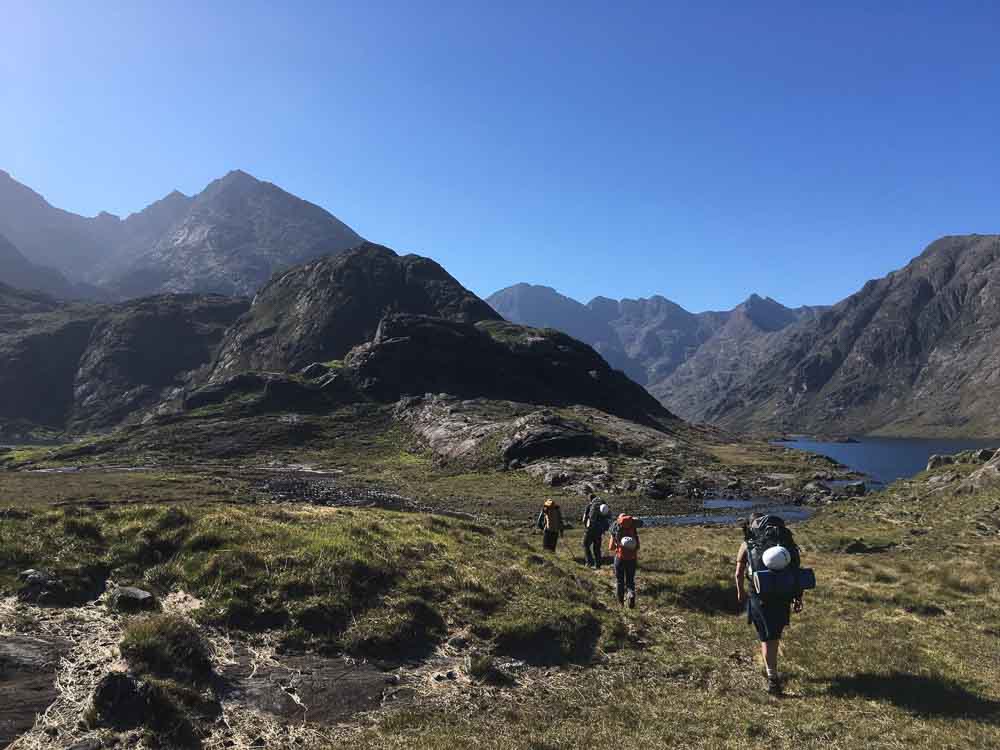
The Dubh Ridge, Isle of Skye
Distance: 12km
Ascent: 1100m
Technical Difficulty: Moderate rock climb
There is a saying that you don’t climb the Dubhs, you ‘do’ the Dubhs – and it’s true that this slabby ridge of grippy gabbro at its off-kilter angle requires a unique style of half walk, half climb to ascend. The adventure really starts well before the ridge; a journey to Loch Coruisk, the dark heart of the Black Cuillin, must be undertaken, either by foot via the sandy bay of Camasunary or boat from Elgol. The Dubh Ridge is a striking line from Loch Coruisk stretching to the summit of Sgurr Dubh Mor, and is the longest in the UK. Two thirds of the way up this Moderate rock climb, is an impasse which requires a 20m abseil. There is a crafty route to the south which avoids the abseil, but this is surprisingly tricky to find. Scrambling leads to Sgurr Dubh Mor, one of the 11 Cuillin Munros. However, it is not all over on this summit; to descend you must first continue at Grade 2 scrambling to the main ridge. From here many descend to Glen Brittle. Alternatively, it is possible to return to Loch Coruisk by clambering over large boulders into An Garbh-choire.
One of the Torridon Trinity, Liathach – Image: Simon Verspeak, Orange Mountaineering
Torridon Trinity: Liathach, Beinn Alligin, Beinn Eighe
Distance: Liathach 11.5km, Beinn Alligin 10km, Beinn Eighe 18km
Ascent: Liathach 1300m, Beinn Alligin 1200m, Beinn Eighe 1115m
Technical Difficulty: Liathach Grade 2 scrambling, Beinn Alligin Grade 1 scrambling (can be bypassed), Beinn Eighe: Mountain walk
Torridon has three giants named Liathach, Beinn Alligin, and Beinn Eighe. Their isolation mean that these peaks are three separate days in the mountains and to climb all three of them over three days would be a quite a challenge. All are demanding mountain routes and the traverse of Liathach involves Grade 2 scrambling. Bienn Eighe involves the biggest day to take in its two Munros on the western end of this huge hulk of a mountain. Beinn Alligin also has some scrambling on the section known as the Horns of Alligin. The village of Torridon is a magical place to be based for these days out in the mountains.
Loch Mullardoch Round, Scottish Highlands
Distance: 56km
Ascent: 6050m
Technical Difficulty: Multi-day mountain walk
Loch Mullardoch is surrounded by 12 Munros, and to walk them all would be a multi-day affair for most. This long, high-level route doesn’t involve any technical ground, but is an endurance challenge of long days and thigh-burning 6000m of ascent. For those who would like to climb some of these Munros but wish to shorten the journey, get a boat (if pre-arranged) to the far end of the loch and begin in this way.
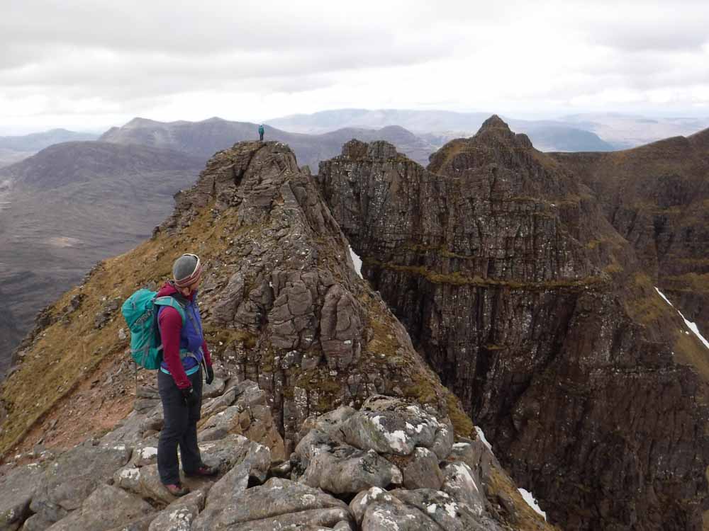
An Teallach Ridge and Toll an Lochan, North West Highlands
An Teallach, Northwest Highlands
Distance: 16km
Ascent: 1400m
Technical Difficulty: Grade 3 scrambling
At the northern tip of the Fisherfield Forest (an area confusingly lacking trees) is the mighty ridge of sandstone of An Teallach. It is normal to park near the Dundonnell Hotel and follow the track towards Shenval. Before descending to the picturesque bothy, the ascent towards An Teallach is begun. Once the ridge is gained, sticking to the crest gives some exciting scrambling. It would be a shame to bypass any of the scrambling, although it is possible on many sections. After the highest peak of Sgurr Fiona (1060m) is gained, the scrambling eases and from Glas Mheall Liath a simple descent returns the intrepid scrambler to the lochside and celebratory fish and chips in Ullapool.
Rum Cuillin traverse, Isle of Rum
Distance: 25km
Ascent: 1900m
Technical Difficulty: Grade 2 scrambling is unavoidable (Moderate climbing which is avoidable)
The Rum Cuillin is virtually unknown to most compared to the Black Cuillin on the Isle of Skye. The mountains may not be as big, and the scrambling not as sustained as the Black Cuillin, but it is high on adventure and remoteness. The majority of the scrambling on a traverse of the Rum Cuillin is at Grade 2. There is a section of moderate climbing if the ridge on Askival is taken direct, but this is avoidable. What with the two-hour ferry journey from Mallaig, and the length of the full circuit, this outing is more like a mini expedition than your usual mountain walk or scramble.
Garbh Bheinn of Ardgour Pinnacle Ridge, West Coast of Scotland
Distance: 10km
Ascent: 950m
Technical Difficulty: Grade 3 scrambling
Garbh Bheinn is a striking mountain which most only see from the Ballachulish bridge on the way to Fort William; few stop and take the ferry over the Corran narrows to Ardgour just minutes away. There are adventurous climbs and scrambles on the northeast face of Garbh Bheinn which is accessed via a boggy path up Coire an Lubhair. Pinnacle Ridge is a Grade 3 scramble and an exciting way to reach the summit. Once this is reached, the scrambling is over, but the journey can be continued onto the secondary summit from where a descent can be made down Sron a’ Gharbh Choire Bhig, which leads neatly back to the parking.
Glen Rosa Round including A’Chir traverse, Isle of Arran
Distance: 21km
Ascent: 2150m
Technical Difficulty: Moderate climbing
On the Isle of Arran, the skyline of Glen Rosa incorporates some magnificent scrambling over the granite mountain tops and ridges. Opposite Goatfell, and on the western rim of Glen Rosa, lies the A’Chir. A traverse of A’Chir involves some fierce scrambling of up to Moderate climbing in difficulty, which many will feel grateful for having a rope. After this excitement, some may feel satisfied and a descent can be made into the glen. However, in fine weather and on long early summer days, the fit and determined will be rewarded by continuing along the skyline onto Cir Mhor. The final summit of Goatfell, the highest summit on Arran, is a magnificent viewpoint across the island.
Aonach Eagach, Glencoe
Distance: 10km
Ascent: 1150m
Technical Difficulty: Grade 2 scrambling
The infamous ridge of the Aonach Eagach links the two Munros of Meall Dearg and Sgorr nam Fiannaidh. Both Munros can be accessed without taking on the length of the ridge, but where’s the fun in that? The route is mostly done east to west. This enables the journey to finish in the equally famous Clachaig Inn, which is as good a reason as any. The scrambling is both in ascent and descent and begins with a tricky step down from the first Munro top of Am Bodach in descent towards Meall Dearg. The main ridge begins after Meall Dearg, culminating in the Pinnacles. Once the Munro top of Stob Coire Leith is reached the main difficulties of the ridge are over, however the descent from Sgorr nam Fiannaidh should be considered carefully. It is not adviseable to take the direct route, descending beside the Clachaig Gully; instead head towards the Pap of Glencoe and descend from the bealach there.
Jack’s Rake takes an obvious groove line across the precipitous face of Pavey Ark – Image: John Fleetwood, author of the new guidebook ‘Scrambles in the Lake District – South: Langdale, Coniston, Eskdale, Patterdale’
Jack’s Rake, Langdale, Lake District
Distance: 7km (via the Pikes of Landale)
Ascent: 900m
Technical Difficulty: Grade 1 scrambling
From Great Langdale in the Lake District is a steep, but well-travelled path to Stickle Tarn. The imposing face of Pavey Ark is a dramatic backdrop to the tarn, a diagonal line crossing the face being the only hint of weakness in this fortress. As this face is approached, the route turns from looking impossible to difficult to feasible. From its base it is still hard to understand how this scramble can be a Grade 1, but Grade 1 it is. One exposed step gains the final reaches and emergence onto the summit of Pavey Ark. After such an exhilarating outing it’s a shame to hightail it home. Much more satisfying is to continue over the pikes of Langdale or to take in High Raise.
Napes Needle and Needle Ridge, Great Gable, Lake District
Distance: 8km (Wasdale approach)
Ascent: 830m
Technical Difficulty: Napes Needle is Hard Severe climbing, skipping Napes Needle and doing only Needle Ridge is Very Difficult climbing
Situated in Wasdale in the Lake District, Napes Needle is historically significant as its ascent marked the dawn of rock climbing as a leisure sport. The climb rewarded its pioneers with being the first to stand on this otherwise inaccessible spire of rock. Today, Napes Needle is still no pushover. At a grade of Hard Severe, which is further complicated by the fact that this grade also has to be down-climbed, it should only be tackled by experienced climbers. If, however, this is a bit much for now, the needle can be omitted, and Needle Ridge can be accessed from behind the needle. At Very Difficult, Needle Ridge is not only much easier but can be climbed in a more conventional way, removing any need for hard downclimbing or rope wizardry. The ridge gives fantastic climbing on Great Gable. The route can be approached from Wasdale or Borrowdale and incorporating the summit of Great Gable makes for a grand day.
Sharp Edge, Blencathra, Lake District
Distance: 8km
Ascent: 800m
Technical Difficulty: Grade 1 scramble
Shorter and sharper than the more well-known Striding Edge on Helvellyn, Sharp Edge is a fun way to gain the summit of Blencathra. The rock on the ridge is Skiddaw slate which, if wet, is notoriously slippery, therefore this route is best saved for a fine, dry day. Once on the summit, a fun descent which is fitting to the way up, is the striking Hall’s Fell Ridge. If, however, something a little easier on the knees is desired Scales Fell does the job. Both make a fine circular route with Grade 1 scramble over an iconic Lakeland fell.
Scrambling on the pinnacles of Pinnacle Ridge, St Sunday Crag – Image: John Fleetwood, author of the new guidebook ‘Scrambles in the Lake District – South’
Pinnacle Ridge on St Sunday Crag, Lake District
Distance: 8km (shortest option)
Ascent: 700m
Technical Difficulty: Grade 3 scramble
Tucked away high on the steep, elongated slopes of St Sunday Crag is Pinnacle Ridge. Finding the start of this scramble is the first challenge, but once the Cannon Stone is located from the scree slopes, scrambling can commence. Care must be taken at first, as there is a tricky slab to negotiate, which is especially difficult in wet conditions. The crux is a 6m wall where many will find a rope reassuring. Beyond are the pinnacles and then the summit of St Sunday Crag. Many return to Patterdale from here, but to extend the day it is possible to continue on to Fairfield where there are multiple options for return.
Tour of the Lake District
Distance: Low level route is 155km including a 10km prologue stage from Windermere, total ascent is 5645m.
With high level alternatives: 181km including the 10km prologue stage, total ascent 7940m
Technical Difficulty: Multi-day mountain walk with high and low level options.
This is an exciting route taking in the best of the Lake District. It is not a marked trail but connects the highlights of the Lake District via established paths and routes. A guidebook on the route will be published by Cicerone Press in March 2021. Here is what author Lesley Williams says about the route: “There’s something very satisfying about a ‘Tour of’ multi-day walk, and the idea of a route exploring the very best of the Lake District’s valleys and fells is a fantastic way to get to know this national park and World Heritage site. It’s a fairly tough 155km, nine-day tour beginning in Ambleside, with five felltop high-level options including Helvellyn, Scafell Pike and Coniston Old Man. Overnight camping and accommodation options can be found in Coniston, Dunnerdale, Eskdale, Wasdale, Buttermere, Borrowdale, Grasmere and Patterdale. What’s more welcoming than a traditional Lake District Inn at the end of each day?”
The Pennine Way
Distance: 431km
Ascent: 10,980m
Technical Difficulty: Long-distance trail
The Pennine Way was Britain’s first national trail, opening in 1965. It follows a chain of hills which split the north of England. The trail begins with a bang in Edale in the Peak District with an ascent up Kinder Scout via Jacob’s Ladder. Apart from the Peak District National Park, it also passes through the Yorkshire Dales and Northumberland National Park to finish in the Scottish Borders at Kirk Yetholm. It is a classic upland long-distance trail, exposed to the weather and with challenging moorland terrain. If completed in a single journey, most allow 2-3 weeks for the 268 miles (431km). However, due to its proximity to large conurbations, it lends itself to being hiked in sections rather than a ‘thru-hike’ and using public transport to access each section.
If in need of guiding or instruction on some of the more technical routes on this list, go to: www.bmg.org.uk (British Mountain Guides) and www.mountain-training.org/associations/ami (Association of Mountaineering Instructors)