Back in November I was invited along with a small group of outdoor journos to spend a couple of days in Scotland getting some hill time in with Garmin’s new GPS watch, the Fenix.
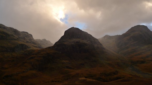
Having had my hands on the Fenix briefly a couple of months previously, I was keen to get into the nitty gritty of the watch which had impressed me with its ease of use and functionality. Heading down to Southampton airport I met up with Charlotte, Greg and the rest of the Garmin crew and jumped on a plane to Glasgow. There we picked up hire cars and made the picturesque drive up to our hotel near Ballachulish on the banks of Loch Leven. Well it would have been picturesque if it hadn’t been dark by this time, although going through through Glen Coe we could just make out some menacing shadows of some of the peaks around us.
We were staying at the Ballachulish Hotel, a typically homely Scottish country lodge that had recently played host to Daniel Craig and the Skyfall cast no less, during the filming of scenes in Glen Coe. After a hearty meal and a wee taste of some single malts, we headed off to bed in anticipation of the next day’s activities.
On the hill
Aonach Mor (1219m) had been chosen as the venue for our Fenix testing – no doubt because of the ease-of-access that the ski gondola provides – and in no time we were up on the hill and syncing our watches. Greg had set up some waypoints on his PC before we left the hotel and now those Fenix’s that hadn’t already been loaded up with these had the data transmitted to them via the Ant wireless protocol.
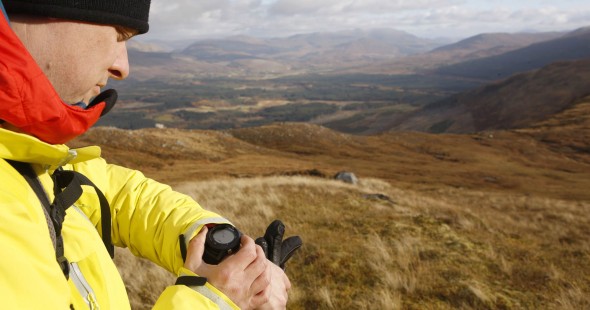
We set off towards our first waypoint, and as we walked along the experts from Garmin gave us pointers on the finer points of the Fenix’s workings. The basics are pretty straightforward: once you set a course, the Fenix shows you what direction to walk in with its compass and calculates how far you have gone, how far you have to go to the waypoint, and all the while giving you your altitude too and ascent gain. You can set up the watch to alert you when you get close to your waypoint too, and at any point you can use the brilliant Trackback feature to take you back to where you began (or a previous waypoint).
Starting the GPS function also means you are ‘recording’ the actual route (rather than the Route you have set up previously) you take as a Track, and one thing I’ve learned when using the Fenix is to save the track at the end of each day, and reset the data so that when you Start GPS again on another day, it doesn’t continue your Track from the previous outing.
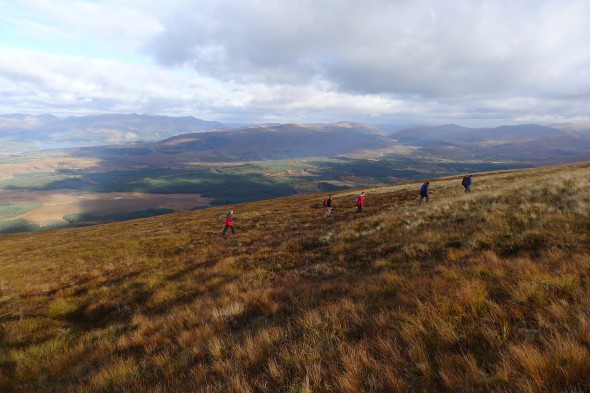
After a lunch break at the ski tow, we headed up Aonach an Nid, and here the weather started taking a wintery turn. With extra layers donned, we followed our mountaineering instructors up the ridge as a bitter wind whipped across bringing a dusting of snow to the hills. Because of the nature of the exercise we all tended to be spending a lot of time looking at the screens of our watches, but of course normally you would need to be concentrating on where you are walking and just checking position on the Fenix once in a while. In poor visibility this is crucial, as there may be drop-offs just feet away from you that require your full attention.
Because of the harsh weather we decided to skip our final waypoint and head back to the gondola, but we’d had some really useful time with the Fenix, and having ‘live help’ on hand from the Garmin team really speeded up the familiarisation process with the watch. It just proves the point that no matter how long you spend reading instruction manuals, there’s no substitute for actually using this type of kit.
I’ve been using he Fenix for a while now, and I find it really useful in producing features for Trek & Mountain. For example, for our Great British Mountain Days features, I simply press ‘Start GPS’ at the beginning of the day and stop it at the end of the day. Once back in the office I connect he Fenix to my Mac running Garmin’s BaseCamp software, and the exact route we’ve taken that day is displayed on OS mapping. We then use this to show in the magazine. The beauty of this – rather than plotting an approximate route – is that since I have been out with a mountaineering instructor, leader or guide, their exact route is recorded which may well include useful or interesting variations on standard routes.
Creating Adventures
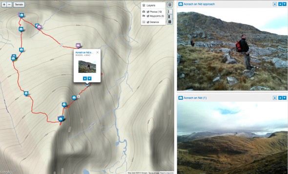
The fact that the Fenix and BaseCamp work so well together is great, but Garmin have taken things one step further and allows you to create your own ‘Adventures’, which combine your route and waypoints with geotagged photos you’ve taken on your route and also allows you to add notes and descriptions that will help others intending to do the same route, or just remind you about aspects of the route next time you do it. You can check the ‘Adventure’ from our Scotland trip HERE, and also see a screengrab of it below. You can share your Adventures with others of course, and join in the community. Adventures is a great tool which I think lots of Garmin users and organisations will pick up on, and has great potential to be developed in the future – and best of all, it’s free!
After coming off the hill, we drove up to Glen Coe to catch some stunning views before hitting the hotel again for some well-deserved food and single malts. The next morning saw us heading back down the road to Glasgow and catching the flight back to Southampton. It had been a thoroughly enjoyable couple of days, and thanks go to the Garmin team for organising such a pleasant and enlightening trip.
Final thoughts? Well, I liked the Fenix from the moment I started using it, and my opinion is that it is the ideal companion to a map and compass, providing vital info without the need for carrying a standard handheld GPS. It’s the perfect trekker and mountaineer’s watch really – let’s face it, you’ll be wearing a watch anyway, so you may as well wear one that gives you as much useful info as possible. At the very least you have a device that will give you a instant grid reference wherever you are.
On Mt Meru and Kili recently, our guide constantly checked with myself and fellow team-member Jonny (who also has a Fenix) to see what altitude we were at, and how far we had travelled. He knew roughly how high and how far we’d come, of course, as he’d guided the routes many times – but clearly he took some reassurance from the readings the Fenix was giving. And therein lies its appeal. No matter if you know a route already, or are using map and compass, the Fenix gives you extra data to back-up the knowledge that you already have, or alert you to a possible mistake or discrepency in your plans/calculations. And if conditions get really bad or when you are just plain lost, the Fenix could be worth its weight in gold to you.
RELATED LINKS
Nevis Range Experience Adventure
Garmin Fenix info


Comments
Hi!
How do you set it to read out a 6 figure OS grid reference (GB)?
I have one and because the manual is worse than awful, I have yet to figure out how to use it for the only intended purpose I bought it for (to double check my location using an OS grid ref).
Please can you help?
Any advice gratefully received…
James.