Noone has commented on this article yet.
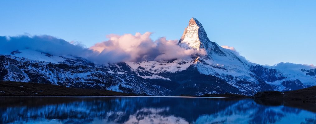
The Matterhorn (Cervin or Monte Cervino) is the epitome of the majestic peak, among the most famous mountains in the world but correspondingly overcrowded. This does not deter most climbers, and even those who think they can resist its popularity usually change their views when they actually see the mountain.
The drama of its first ascent underpins its fame. The race, into which the final attempts degenerated, was decided by Edward Whymper and his equally driven companions, Lord Francis Douglas, Charles Hudson, Douglas Hadow and the guides Michel Croz and Peter (father and son) Taugwalder on 14 July 1865 by their successful ascent of the North-East (Hörnhi) Ridge. But after an accident on the descent, only Whymper and the Taugwalders returned. The harder Italian Ridge was mastered three days later by Whymper’s former ally Jean-Antoine Carrel with Abbé Gorret, Jean Baptiste Bich and Jean-Augustin Meynet but only Carrel and Bich did the devious finish above Pic Tyndall (by a traverse to the Zmutt Ridge). A direct finish was done in 1867 by Jean Joseph and Pierre Maquignaz and soon equipped with ropes and a short ladder (a process that also ‘tamed’ the Hörnli Ridge). The still largely unequipped Zmutt Ridge was climbed in 1879 by Albert Mummery with Alexander Burgener, Johann Petrus and Augustin Gentinetta, and the North Face ascent by Franz and Toni Schmid (1931) also made headlines.
Hut climb: From Zermatt railway station walk through the town and head up the valley to Winkelmatten. From there cableways lead to the Schwarzsee. Those resisting this temptation should follow the western bank of the Mattervisp to the junction of the Zmuttbach. Follow that for about 600m, then cross the bridge to the Zum See district (1766m). Take the Stafelalp path, but go left at the first fork on the path to Hermettji (2053m). Here, continue right (many bends) up the ridge to the Schwarzsee Hotel (2584m) and the Schwarzsee (2-3 hrs). Continue west on the broad path (grassy humps, moraine debris) to the dark rock wall of the Hirli. Before reaching that, first ascend left then cut back right to gain the ridge. The path leads up, with numerous short bends, to gain the shoulder with the Hotel Belvedere and the Hörnli Hut (260m, SAC Section Monte Rosa, 60B, usually overcrowded; managed: mid-June – mid-September, Tel.027-9672769).
Summit route by the Hörnli Ridge: Generally the route stays to the left (east side) of the ridge and only above the Solvay Hut does one keep more generally to the ridge edge. If one plans a nighttime start, a reconnaissance of the lower section of the route is advisable.
From the Hörnli Hut, follow a horizontal ridge to a step. Move up this obliquely left (fixed rope) and traverse left (tracks) to a shoulder on the East Face. Ascend a little further in the direction of the ridge then traverse left to the East Face. There, cross a couloir and traverse further to a second couloir. Go up that for about 25m and then move on to a rock rib on the left (right of a third couloir) and follow this back to the ridge. On the ridge, climb about 100mH on good holds (tracks, crampon scratches) as far as a ledge of yellowish rock. Follow this left on the face to its end. Zig-zag directly up to the ridge to a rock tower which bars the way (remains of an old hut in front of it, 3818m, 2 hrs from the Hörnli Hut). Make another long detour left up across the face to a slabby recess, cross a rock band and continue up left until below the Solvay Refuge. Climb up on increasingly steeper rock to reach the near vertical ‘Moseley Slab’ (III-, iron peg for belay) which goes directly up to the Solvay Hut (4003m, 3 hrs from the start). Move left round the hut and go up a slabby gangway set between steeper rocks and soon move back up (the Upper Moseley Slab, III-) to regain the ridge, which is followed over blocks. Turn the Red Tower on the left and after that go up the ridge to the ‘Shoulder’ (mostly snow and ice with iron belay pegs).
Climb a short snow and ice ridge and the crest of the ridge above to gain the steep summit block. Keep on the edge using steep cracks and steps, on which thick, greasy fixed ropes obtrude as aids to heaving oneself up inelegantly. Thus one reaches the often icy summit slope and soon afterwards gain the highest point (at the eastern end of the Summit Ridge).
South-West or Italian Ridge (AD, III and fixed ropes (without these, IV), a better climb than the Hörnli Ridge, but overall more tiring and for that reason is often done in descent).
From Breuil (2006m) go to the Duca degli Abruzzi Hut (2802m, 2-3 hrs). Take the path to the Croce di Carrel and go up a gully heading obliquely left over a rock barrier to a rock ridge. Traverse to and climb the eastern edge of the snow-field under constant threat of stone-fall to a rock rib under the summit block of the Tête du Lion. Go right on ledge, crossing some gullies (stone-fall, delicate), to the Col du Lion (3580m). Keeping on the south side of the ridge, climb a succession of slabby rocks using fixed ropes to reach and climb the ‘Seiler Slab’ and above the vertical 12m ‘Whymper Chimney’ (chain), followed by more slabs (fixed ropes) leading to the Savoia Hut (only for emergencies) and the Rifugio Carrel (3829m, 40B, radio telephone; 4-5 hr from Aosta Hut).
Turn the pinnacle ridge above on the south side (many fixed ropes) passing the ‘Mauvais Pas’ (a toe ledge) and ‘Linceul’ (a small patch of ice) to a wall with another fixed rope (‘Corde Tyndall’) which leads to the ridge. Continue up that, turning most obstacles on the left, to the Pic Tyndall (4241m, 3 hrs). Move across the almost horizontal ridge, and cross a deep notch (‘Enjambée’), to gain the summit block. Follow the obvious line of the ropes and up a rope ladder (‘Echelle Jordan’) to the West (Italian) Summit. A short climb along the summit ridge (with notch) leads to the main summit (5 hrs from the Carrel Hut).
Maps: LKS 1348 Zermatt, LKS 1347 Matterhorn, LKS 5006 Matterhorn-Mischabel.
Travel: The valley base is Zermatt.
View: Overwhelming – from Mont Blanc, Dent d’Hérens and Grand Combin in the west to the northern giants of Dent Blanche, Obergabelhorn, Zinalrothorn and Weisshorn to the Mischabel group with Dom, Täschhorn, Alphubel, Allalinhorn, Rimpfischhorn and Strahlhorn and further to Monte Rosa, to the Liskamm and the Breithorn in the east. To the south the distant view is unexceptional but the view down the mountain itself leaves nothing to be desired.
Adjacent peaks: The not very prominent West Summit (with an iron cross) is at 4476m. Pic Tyndall (4241m) is traversed on the ascent of the Italian Ridge.
Other worthwhile routes: North-West/Zmutt Ridge (D, IV- and III, mixed, seldom in good condition, snow or ice to 50°, the great classic Matterhorn ridge, 1200mH, 7-9 hrs from the Hörnli Hut – the Lonza Hut, erected in 1997 at the foot of the ridge, was soon damaged by avalanche).
South-East/Furggen Ridge (D+/TD, IV, direct up to VI, unstable rock; 1150mH from start of climb, 8-12 hrs).
North Face (TD, steep ice and IV, or V, delicate unstable rock, one of the great alpine north faces, 1100mH, 10-12 hrs).
Guidebooks: Valais Alps West (Alpine Club, 1998).
**BOXOUT**
Difficulties: AD- Despite the fixed ropes and other equipping this is still one of the hardest Normal Routes on a 4000m peak more for its length, the care demanded on the constant rocky terrain, and the mountain’s exposure to weather changes, Even with the use of the fixed ropes, there are still passages III-, mostly II (very sustained) and I (if the fixed ropes are not used, there are pitches of IV and IV+, at great height and hence more strenuous), In the summit area there are also difficulties on mixed ground.
The rock on the ridge provides good holds and is enjoyable to climb in dry conditions, but on the faces it is slabby and less secure. Route-finding is easy following the polished rock, but in wet or snow it is less obvious and the smoothness creates difficulties which make the Hörnli route very taxing for climbers of average ability, because of its sheer length.
Effort: If the cableway is not used the Schwarzsee climb is 950mH (2-3 hrs). From the Schwarzsee to the Hörnli Hut is 700mH (2 hrs), the summit climb is 1200mH (c.1700m of climbing, 5-6 hrs). At least 5 hours should be allowed for descent (in poor conditions much longer) on which steady simultaneous movement by all members of the team is a skill that, ideally, should have been perfected in advance.
Dangers: There have been approximately 500 deaths on the Matterhorn and this fact sends a clear message The main danger is the hectic state into which many people drive themselves prompted by the muddle brought about in moving and belaying on the harder passages. As most climbers move together, roped, but generally unbelayed (good natural belays being scarce), there are many opportunities for mishap, particularly during the numerous unavoidable passing manouevres A second substantial danger is the sheer length of the climb which, especially with the onset of bad weather, makes route-finding harder and ensnares many, particularly those who are climbing at their limit. Although most of the original loose rock has now been cleaned there are still loose sections, so stone-fall risk, even though localised, is another big problem.
Further difficulties are added by the ‘polished’ fixed ropes which are only anchored to the rock at long intervals and are bad to grip with gloves on account of their thickness. Regarding equipment, it is not wise to economise on warm clothing, windproof5 or crampons. The Solvay Hut (4003m) placed in a convenient notch on the ridge on the east side, is exclusively assigned as emergency quarters for bad weather or accidents. Several experienced parties have been forced into prolonged stops at the Solvay to await a weather change allowing a safer descent.
Pleasures: Even though the detailed climbing is not of high quality, the ambience of this great symbolic peak and its position is still fascinating. Providing the weather is settled, a well trained party may elect to start in daylight when the route-finding and climbing will be more pleasurable The only problem with this strategy is that of passing the many descending climbers with the corresponding stonefall and hurly burly.


